On this page
Z Alignment Settings
During feature edits, different Z Alignment settings can be selected within the COGO toolbar.
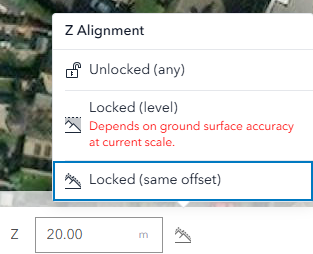
A description of each Z Alignment setting can be found in the following table.
| Z Alignment | Description |
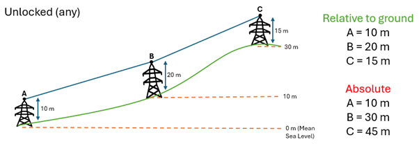
| Unlocked (any) | This mode allows full manual control over Z values (elevation). You can enter different heights for each vertex as you digitise a feature.
Use case: When you want to specify custom elevation values for each point.
|
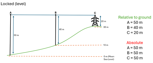
| Locked (level) | This mode keeps the created feature at a consistent elevation relative to reference, regardless of terrain changes. The accuracy of this mode is dependent on the elevation surface and the active map zoom scale whilst digitising.
Use case: When you want the feature to maintain a constant absolute height, even as the ground elevation changes.
|
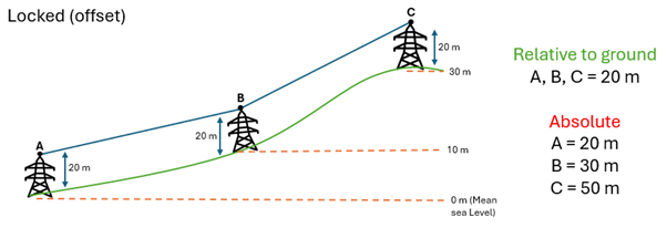
| Locked (offset) | This mode locks the feature to a fixed height at every point as the surface changes.
Use case: When you want the feature to follow the terrain but stay at a consistent height above it.
|
Z Alignment at the layer level
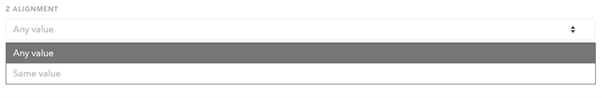
Z Alignment can be set on individual layers within Topology rules in the Data Rules Editor. Certain editing functionality will be hidden from the end user when layers are set to Same value. Please see the link for further information.